Chapter 03 · 1641–1853
Secluded, Yet Knowable
Distance did not stop knowledge. It made access itself part of the image.
In 1641, the Dutch trading post moved from Hirado to the artificial island of Deshima in Nagasaki. Foreign relations continued through regulated channels that also included Chinese trade, diplomacy with Korea and the Ryukyu Kingdom, and northern exchange. In Europe, however, privileged Dutch access, Japanese books and maps, interpreters, specimens, and travellers' reports were repeatedly assembled into an image of a country at once closed and knowable.
Evidence set6 objects · 1735–1833
Method noteThe surviving visual archive is unusually concentrated on Dutch trade and Nagasaki. These sources reveal how controlled contact was pictured, but they do not represent the full geography of Tokugawa foreign relations.
The evidence sequence
How restricted contact became portable knowledge
Scroll through 4 surviving objects. The image changes as the argument advances from one frame to the next.
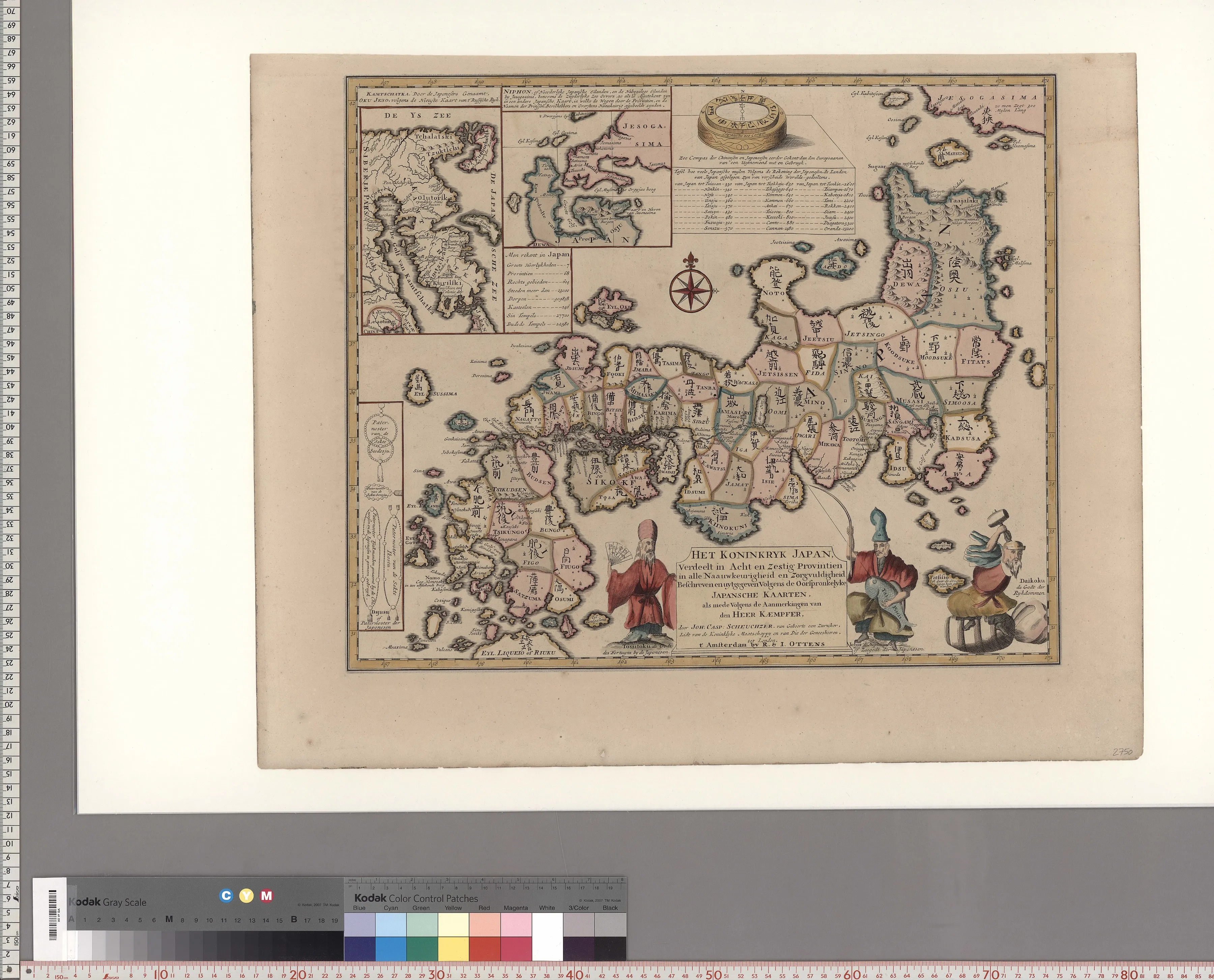
01 / Compilation
Japanese maps become European authority
Engelbert Kaempfer travelled in Japan as physician to the Dutch trading post from 1690 to 1692. Published after his death and reworked by Johann Caspar Scheuchzer, his observations helped European readers treat restricted access as a source of unusually valuable knowledge.
Close readingThe title claims both original Japanese maps and Kaempfer's observations. Province boundaries, insets, costumes, and Dutch text turn translation into visual completeness, even as every element has passed through selection, copying, and European publication.
Open source record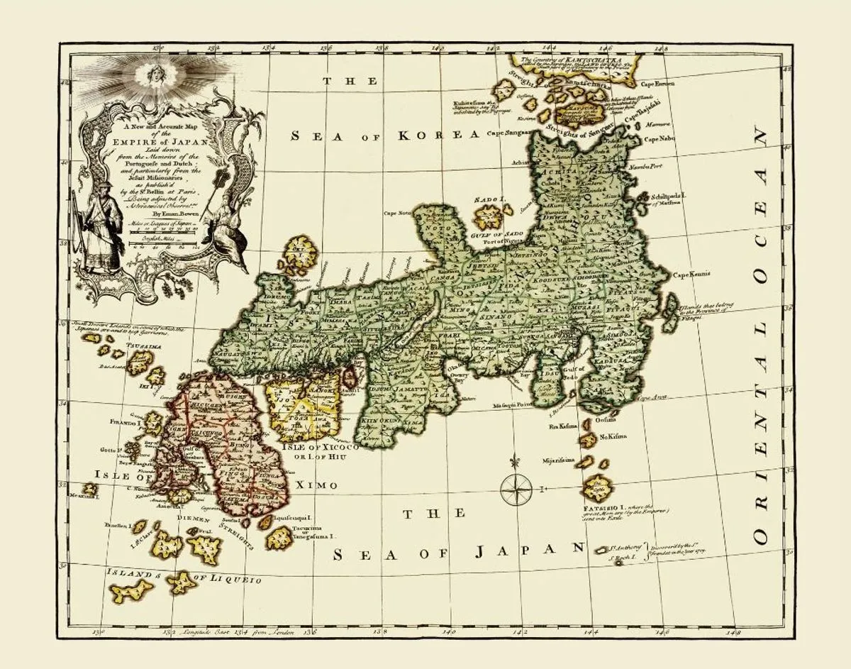
02 / Atlas
Second-hand knowledge looks complete
Emanuel Bowen's atlas map carried Japan into a general view of the known world. Its geography drew on Portuguese and Dutch reports, Jesuit knowledge, and earlier European mapmaking rather than a fresh survey of the archipelago.
Close readingDense labels, neat borders, and the decorated title cartouche suppress the map's layered inheritance. The authority of the atlas converts accumulated fragments into a stable, apparently surveyed country.
Open source record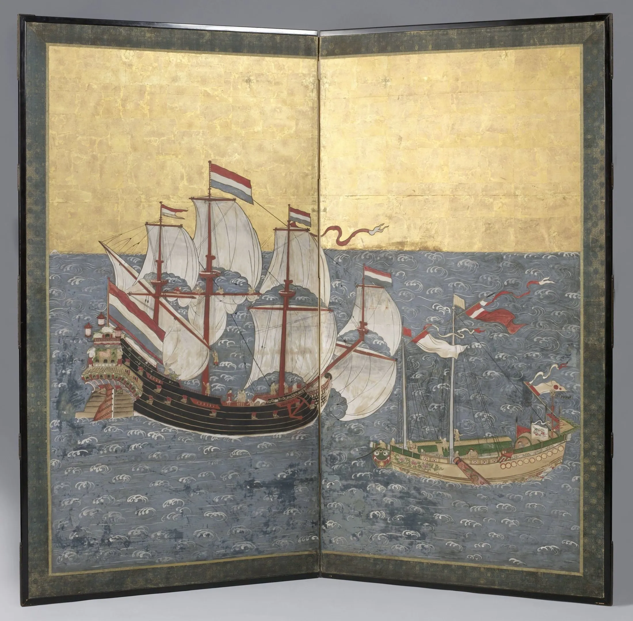
03 / Reverse gaze
Foreign ships become a local genre
A Nagasaki screen places a Dutch East India Company ship beside a Chinese junk. Artists in the port city made foreign merchants, ships, and customs into recognisable subjects for Japanese viewers.
Close readingThe ships are isolated against rhythmic blue water and identified through flags, rigging, hulls, and ornament. This is not Europe looking at a closed Japan; it is a Japanese image ordering the limited foreign presence that the port made visible.
Open source record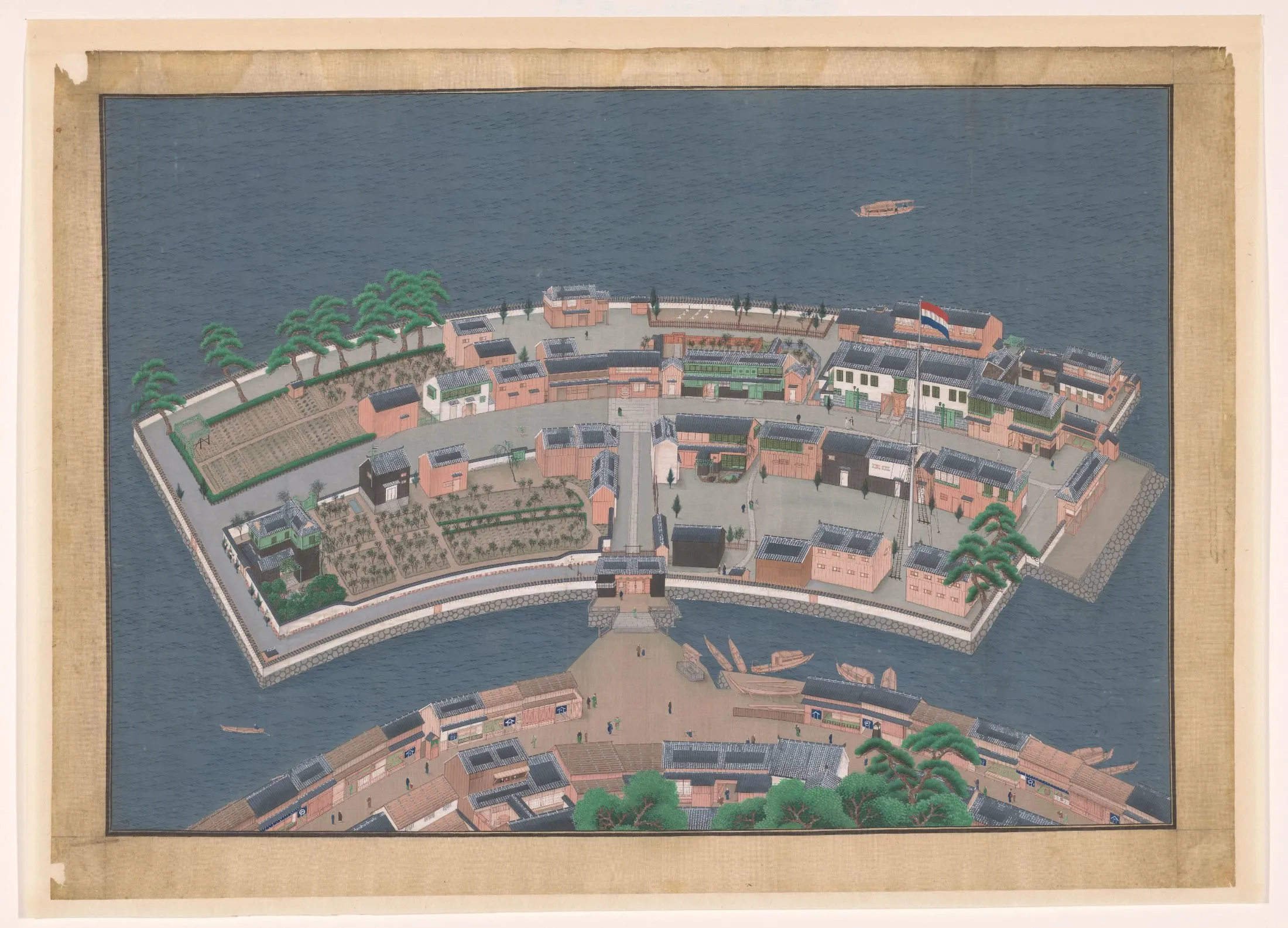
04 / Souvenir
The enclave leaves as a picture
Kawahara Keiga's workshop specialised in detailed views that Dutch personnel could purchase and carry home. This bird's-eye image makes the fan-shaped island legible as a compact system of warehouses, gardens, residences, gates, and bridges.
Close readingThe elevated view seems documentary, yet it is also selective. Dutch and Japanese figures can be distinguished, while the enslaved servants who supported Deshima households are absent. Port knowledge travelled through pictures calibrated for memory and display.
Open source recordCounter-reading
“Closed country” was not a contemporary master plan
The familiar term sakoku entered Japanese debate in 1801 through a translation of Kaempfer, rather than naming the seventeenth-century restrictions when they were issued. Treating it as a complete description risks turning one later concept—and one unusually visible Dutch archive—into the whole history of Tokugawa relations.
- 01Controls redirected foreign relations through authorised routes; they did not eliminate Chinese and Dutch trade, Korean and Ryukyuan diplomacy, or northern exchange.
- 02European print depended on Japanese maps, interpreters, commercial routines, and supervised journeys, so supposedly outside knowledge was co-produced.
- 03Images edited the social order of contact: one Nagasaki print shows two enslaved men from what is now Indonesia at a Dutch meal, while Keiga's souvenir view leaves them out.
Evidence register
Sources in this chapter
- 01Het koninkryk JapanEngelbert Kaempfer and Johann Caspar Scheuchzer1735Restricted access as cartographic authority
- 02An Accurate Map of JapanEmanuel Bowen1752Remote but chartable islands
- 03Japanese Screen with a VOC Ship and a Chinese JunkGenkei-school, Nagasakic. 1759Foreign ships under a local gaze
- 04View of DeshimaWorkshop of Kawahara Keiga1833–1836A souvenir edits the enclave
- 05Dutchmen at a MealAnonymous Japanese printmaker; after Rin Shihei (attributed)1790–1810Europeans as local spectacle
- 06Dish with a Map of Japan and InscriptionAnonymous Japanese potterc. 1830–1844Managed contact becomes maritime anxiety