Chapter 01 · 1275–1543
Cipangu Before Japan
Cipangu became useful before Japan became observable.
Marco Polo did not visit Japan. Yet the island he described crossed languages, formats, and generations. Copyists gave the report authority, cartographers gave it coordinates, and printers gave it a repeatable outline—well before Portuguese ships reached Tanegashima.
Evidence set6 objects · 1290–1528
Method noteThe chapter begins with a late-thirteenth-century report, but its surviving witnesses are later. That delay is not a gap to hide; it shows how Cipangu was repeatedly remade in transmission.
The evidence sequence
How a reported island became a destination
Scroll through 4 surviving objects. The image changes as the argument advances from one frame to the next.
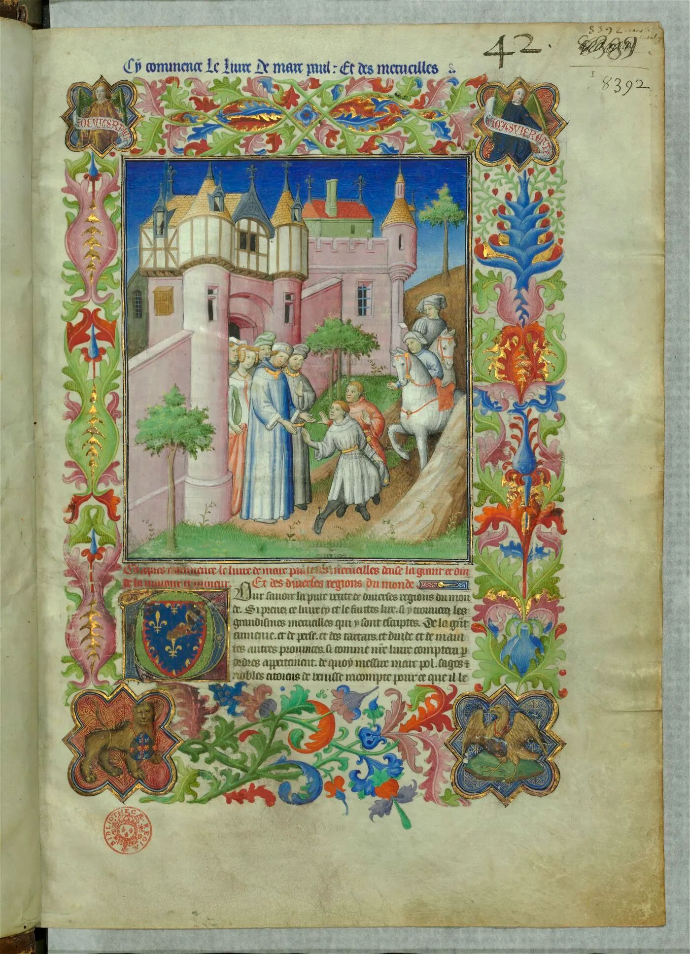
01 / Manuscript
A report enters the treasury
In Paris, Marco Polo's account was gathered into a lavish book of marvels for an elite patron. Gold, decorated borders, and careful compilation made distant testimony feel durable long after the journey itself.
Close readingThis opening does not picture Japan. It pictures the social machinery that made an unseen island credible—costly materials, named ownership, and the prestige of a collected world.
Open source record
02 / World map
The island moves with the world
Waldseemüller's 1507 map placed Polo's Asian geography beside news of Atlantic voyages. Cipangu survived, but within a world whose oceans and continents were being radically rearranged.
Close readingAt the eastern edge, islands become small marks inside an enormous hypothesis. Their apparent position is not measurement from Japan; it is an attempt to reconcile inherited description with new routes.
Open source record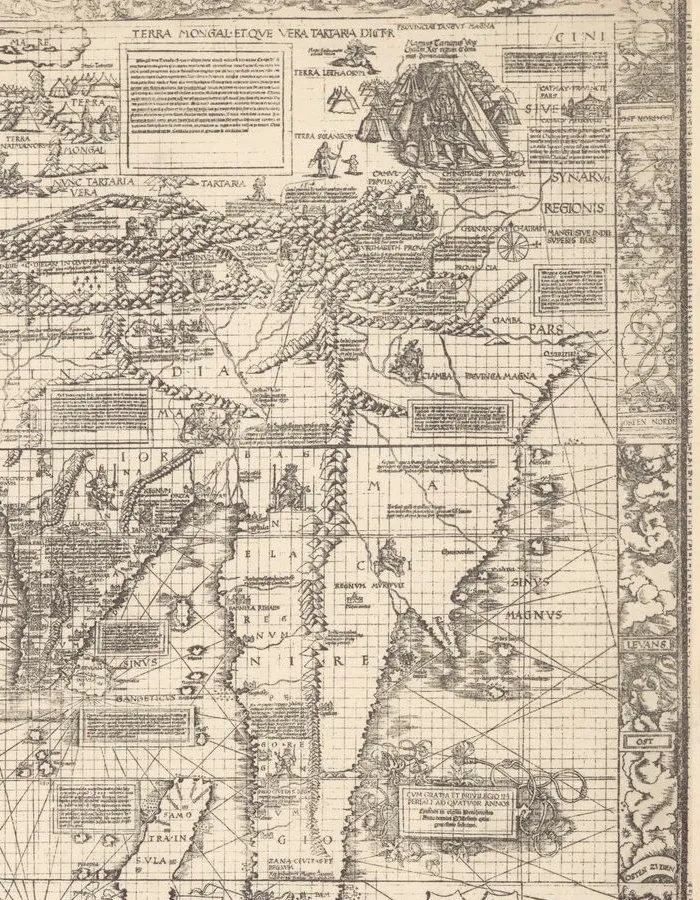
03 / Revision
New navigation, inherited names
Nine years later, the Carta marina replaced the earlier map's classical frame with denser coastal knowledge, ships, winds, and travel reports. Asia looked more navigable, even where direct European observation remained thin.
Close readingRevision did not erase inherited geography. The map demonstrates how new maritime evidence and old textual authorities coexisted rather than replacing one another in a clean sequence.
Open source record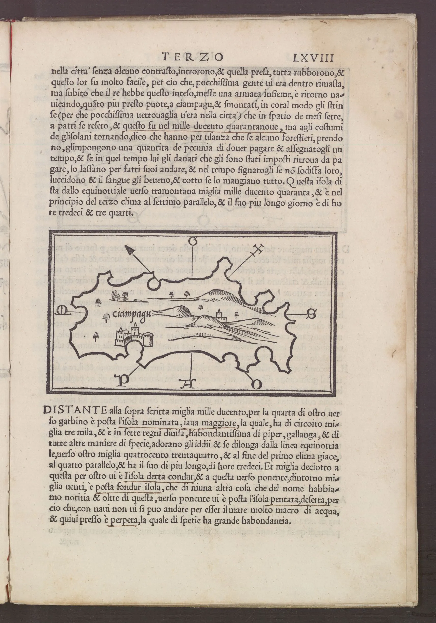
04 / Island book
A destination gets an outline
Bordone's Isolario isolated Ciampagu on its own page. A jagged coast, hills, trees, and fortified settlements converted a famous name into a compact, reproducible object for readers.
Close readingThe outline is not a coastal survey. Its confidence comes from the printed frame, directional signs, and accompanying prose—not from observation of the Japanese archipelago.
Open source recordCounter-reading
A catalogue date is not a guarantee
The so-called Map with Ship is catalogued under Marco Polo and a thirteenth-century date, but the Library of Congress also records its authenticity and provenance as undetermined. It belongs here as evidence about attribution, not as proof that Polo mapped Japan.
- 01Later objects can preserve an early story while changing its geography and emphasis.
- 02Archive descriptions may retain historical claims while explicitly warning that those claims are unresolved.
- 03“Cipangu” was a portable European expectation, not a stable synonym for the Japanese islands.
Evidence register
Sources in this chapter
- 01Opening of the Livre des merveilles du mondeParisian illuminators working for John the Fearlesscirca 1410–1412Authority through compilation
- 02East Asia on Waldseemüller's world mapMartin Waldseemüller1507Inherited island in a revised world
- 03East Asia in the Carta marinaMartin Waldseemüller; reproduction associated with Albert Kammerer1516 map; later reproductionMaritime revision
- 04Ciampagu in Bordone's IsolarioBenedetto Bordone1528A destination gets an outline
- 05The gold and invasion of CiampaguBenedetto Bordone1528Polo retold in print
- 06Map of the Far East and adjacent Pacific, known as Map with ShipAttributed to Marco Polo in the catalogue record; attribution unverifiedcatalogued as [129-?]; authenticity undeterminedArchive uncertainty